R.V. (“Dick”) Dietrich
Most recent update: 8 August 2018
The following web site
http://www.mibarn.net/MacCoAlbum/Mac%20County%20Barns.htm
is a
slightly modified version of the original file,
It
includes the
text and full
captions -- i.e., information
about each barn and a few other barnlike buildings.
The above noted web site does not have most of the
additions made to the original file since mid-2011. Also, most of
the photographs that are on that site are smaller than those on this
website. Consequently, this site is an "Album of photographs"
that include the 135 barns included in the original report at their
originally published sizes and relative dimensions along with similarly
sized photographs of subsequently added barns. etc. (see below).
However, this site does NOT include full captions, several of which
include additional information about the given barns; to see that
information go the the Barns website.
The additional barns ... the photographs and
captions of which have been added to the original report, and are not
on the barns web site follow:
1. photographs and full captions
for four barns that have
been
recorded
since the original report was
prepared --
Ga63, Ga64, Ne12 and Ne13;
2. captioned photos
that update
Br2 and Ma3;
3. a
barn-shaped (& so-named) structure
that has never functioned as a farm barn,
Br13;
and
4. corrections & additional
information for
Ga39,
Ga50, and Mo4.
~~&+&~~
Acknowledgments
to the County
residents who
allowed access to their
properties and supplied
information about
these barns are also
given on this web site; they followthe frontispiece.
| Home
|
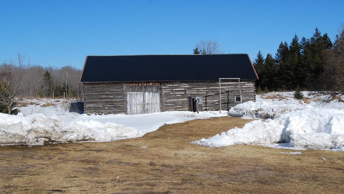
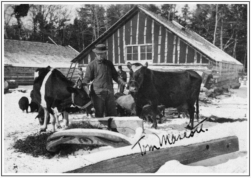
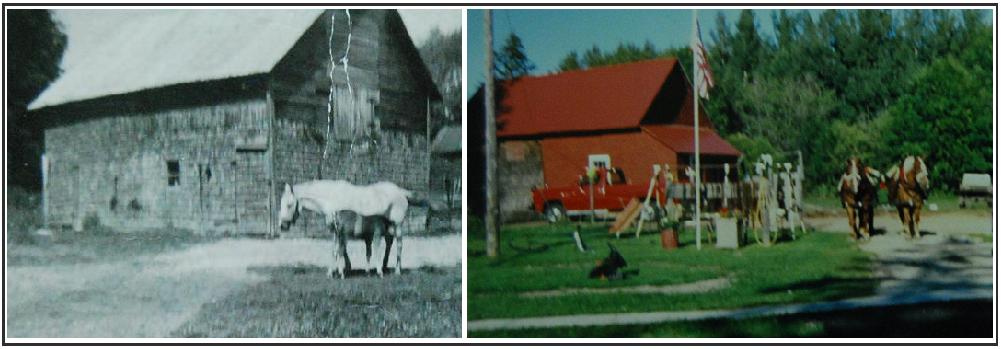
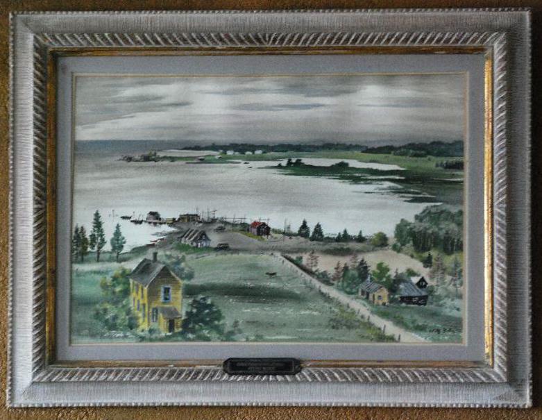
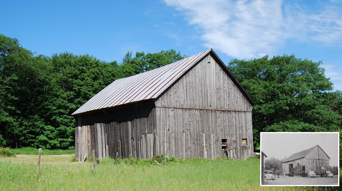
Frontispiece.. Barn Mo3 in
Moran Township. The original black and white photograph, which was
taken in the 1930s, is in collection of Chuck
Collip.
Acknowledgments
The preparation of an album about old
barns in Mackinac county was suggested by Robert Bruce Brown, my
son-in-law. It was subsequently promoted by Rick and Kurt Dietrich and
Krista Brown, my wife's(d) and my “kids,” who have a much higher
opinion of my photography than I do. Bob's suggestion and our kids'
promoting it were, I feel sure, based on their knowing that I was just
about to finish a project and needed another one "to keep me out of
mischief."
Each of my "kids" helped in several ways as I photographed the barns,
sought information about them, and was preparing this album: Each of
them gave me suggestions and discussed diverse aspects of my
photographs and the information I collected. Kurt and Krista also drove
for me on some of my trips to find and photograph the structures and
contact people who gave me information to include in the captions. Bob
Brown, my son-in-law, helped me with contacts and supplied valuable
information about the area, its people, etc. that only one who has
lived in this area virtually all of his life could do. Kurt and Rick read and critiqued the complete
report.
Charlie Brown, an attorney in St.
Ignace, drove me to view and photograph three of the barns in and near
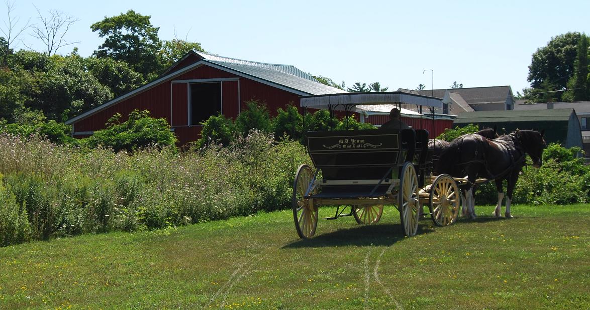
St. Ignace and supplied data about them. Buck Sharrow took me by horse-drawn carriage (carriage
and horses courtesy of Mike Young of Frankenmuth, Michigan) to see the
many horse stables on Mackinac Island and supplied basic information
about each of them. Prentiss
M. ("Moey") Brown, Jr., an attorney in St. Ignace, served as a valuable
source of historical information about the area in and around St.
Ignace. Mary Hill, and others at the Historical Museum of the Les
Cheneaux Historical Association in Cedarville and Linnea Ault and
others of the Engadine Hisotircal Society Museum in Engadine gave me
information and also the names of people from whom I could get
additional information about the barns in their areas. Linnea Ault also checked the original draft of
the Garfield Township captions.
David Ginsburg, Research Librarian
Emeritus, Central Michigan University aided me by making searches for
literature dealing with barns, especially those in Michigan, that
contains information that might otherwise have escaped my early
barn-related observations within the county. He also checked the
References given in the full report to make sure that each is in a form
that will facilitate readers that may want also to review those
publications. Gina Kemp, Director, and Barbara Zimmerman, Assistant
Director, of the St. Ignace Public Library, obtained several
publications via interlibrary loan. Gina also supplied one important,
rather rare booklet from her personal library. Vera Wiltse, 4-H Youth
Agent, Michigan State University Extension (ret.), was ever ready and
willing to give professional advice.
The following people supplied
information about one or more the the barns included: Donald Ault,
Linda Belonga, Gary Bigelow, Judy Bishop, Ed Brockman, Barbara Brown,
Elmer & Ruth Brown, Frank Butkovich, Carilon Hopperstead Carr,
Curtis Cheesman, Dan & Amy Christensen, Betty Clark, Chuck Collip,
Nancy & Joe Cornwell, Peter Crystal, Debra Dailey, Frank Daily,
Raymond & Ruth Derusha, Amelia Duberville, Carol Duncan, Andy
Dunikowski, Bob Edwards, Verna Engel, Vern Erskine, Alice Feigel, Dee
Fenske, Ervin Flatt, Wayne Flatt, Ethel Freeman, Fred Freeman, Nancy
Fulton, Roger & Tamara Gady, George & Irene Gage, Gerry Glenn,
Violet ("Marie") Gorman, Dale Greenwald, Jack Gribbell, James &
Faye Gribbell, Clinton & Barbara Groover, Chandler Hadley, Herbert
Hahn, Julia Halonen, Carol Hamel, Michelle Hanson, Gary Heckman, Gayle
Herron, Anthony Hines, Jeffery Hoag, Robert Holland, Dick Huskey,
Rosemary Irwin, Conrad Izzard, Roger Kempf, William Ketola, Mark
Kinjorski, Mike & Rae Klobucher, Teri Kniss, Martin Kopinski, Caryn
Kovar, Wayne & Georgianna Kuebler, Alan & Charles Lamoreaux,
Clarlyn Ledy, Judy Legault, Sharon Legault, Marian Lesatz, Bob Lindley,
Louise Lowetz, Kirt Mahar, Charlie and Louis Markstrom, John
Matchinski, Jessica Maze, Kathy McCabe, Jennifer McGraw, Jonathan
Miller, Leighton Miller, Levi Miller, Richard Miller, Tate Miller,
Wendell Miller, Russel Morris, Kathy Mullholland, Russ Nelson, Tim
Nelson, Mike Newton, Kellie Nightlinger, Charles & Kathy Nye, James
& Cully Ocko, Ed Olson, Gunnar Olson, Bill Orr, John Ozanich,
Herman Patzer, Ray & Carol Patterson, Wes Peckta, Richard
Pershinske, Jon Plomer, Peter Polisse, Peter & Sallee Poole, Freda
Price, Karen Reed, Bambi Robinson, Ervin Rose, Jim Rourke, Betty
Sadler, Sue Salter, Herb Sawyer, Esther Schaum, Edward Schmitt, Violet
Schroeder, Elsie Sellers, Martin Sherlund, Rudy Sherlund, Harold
Shoemaker, Edward Simon,Sharon Smith, Wayne Steiner, Harry Stephenson,
Fred & Marilyn Strickland, Chriss Stutzman, Gladys Tamlyn, Mary Kay
Tamlyn, Susan Thomas, Jerry & Kim Thompson, Charlie Vallier, Mark
Vonderwerth, Jim Vosper, William Wagner, Craig Weatherby, Jake Weiss,
Rick Weiss, Paul Williams, Angela & Jeff Wollos, Jacob Yoder, Ken
& Debbie
Zellar, Melissa Zellar, and Todd Zellar.
I gratefully
thank each of the listed
people for her/his contributions.
R.V. ("Dick")
Dietrich
24 November
2011 / 07 March 2016
~~&&~~
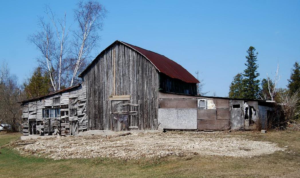
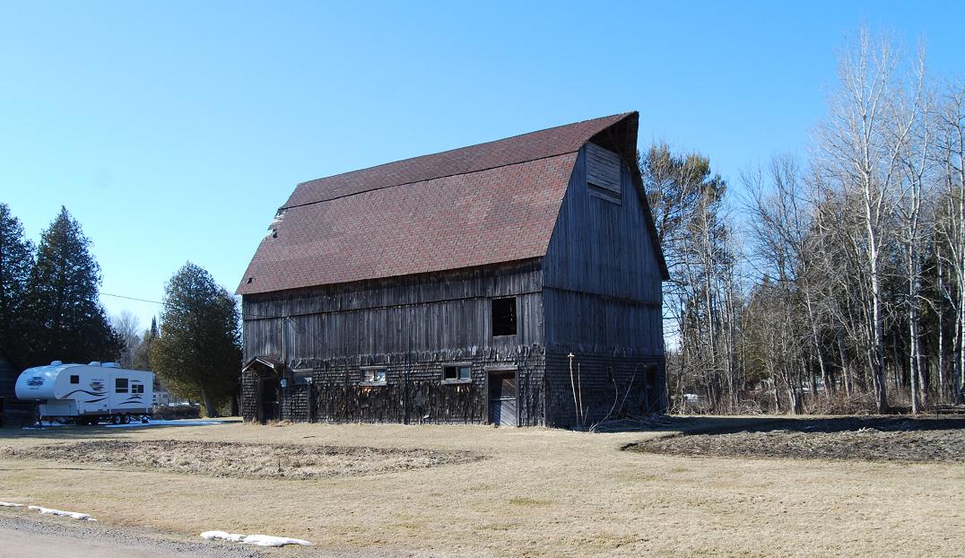
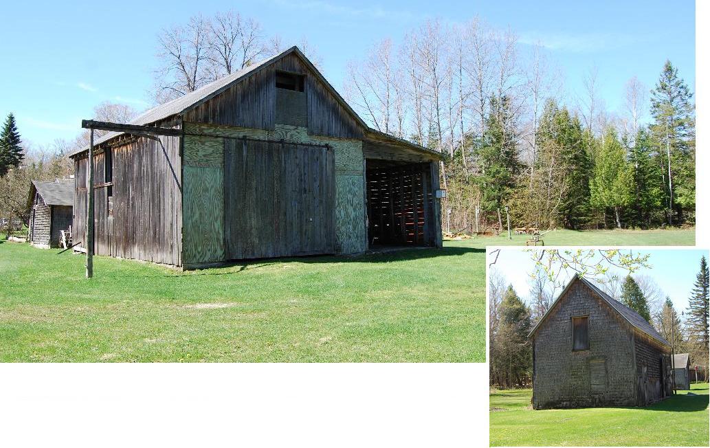
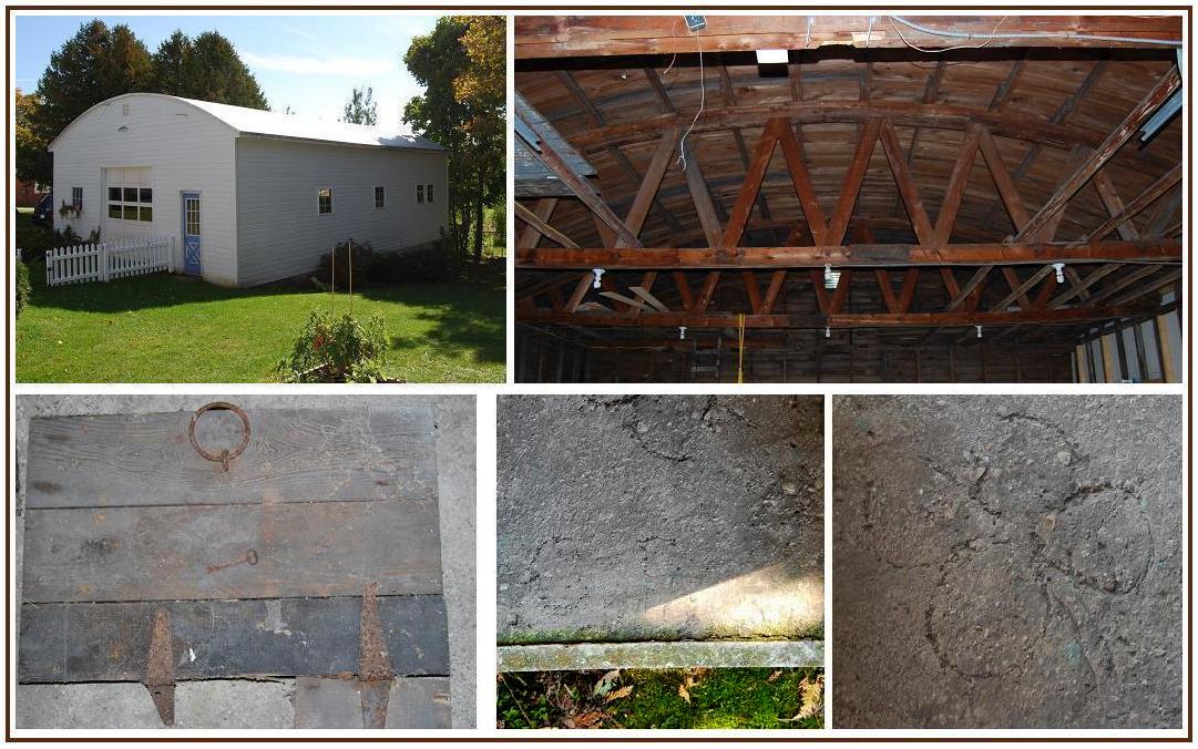
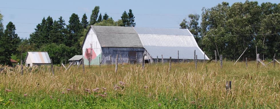
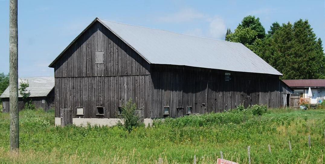
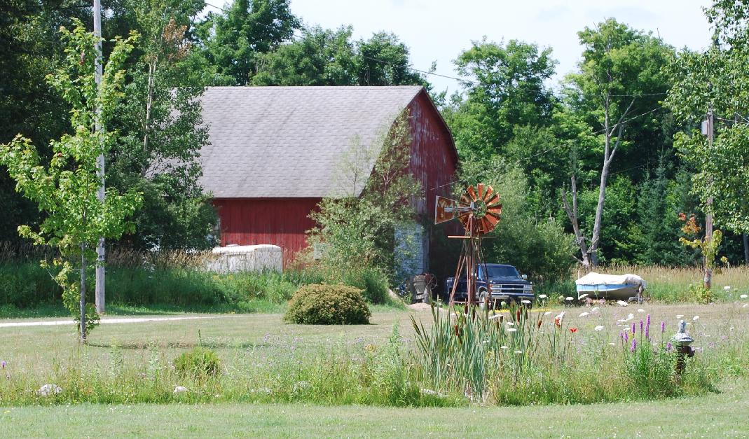
NEWTON
Township. The asterisk
preceding Ne1 and Ne9 indicates that additional photographs and
information about these barns are available in the Engadine Historical
Society Museum.
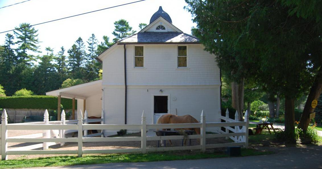
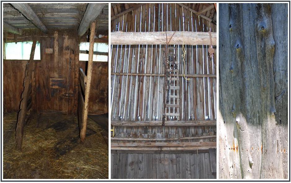
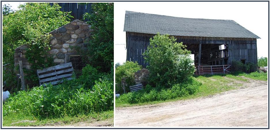
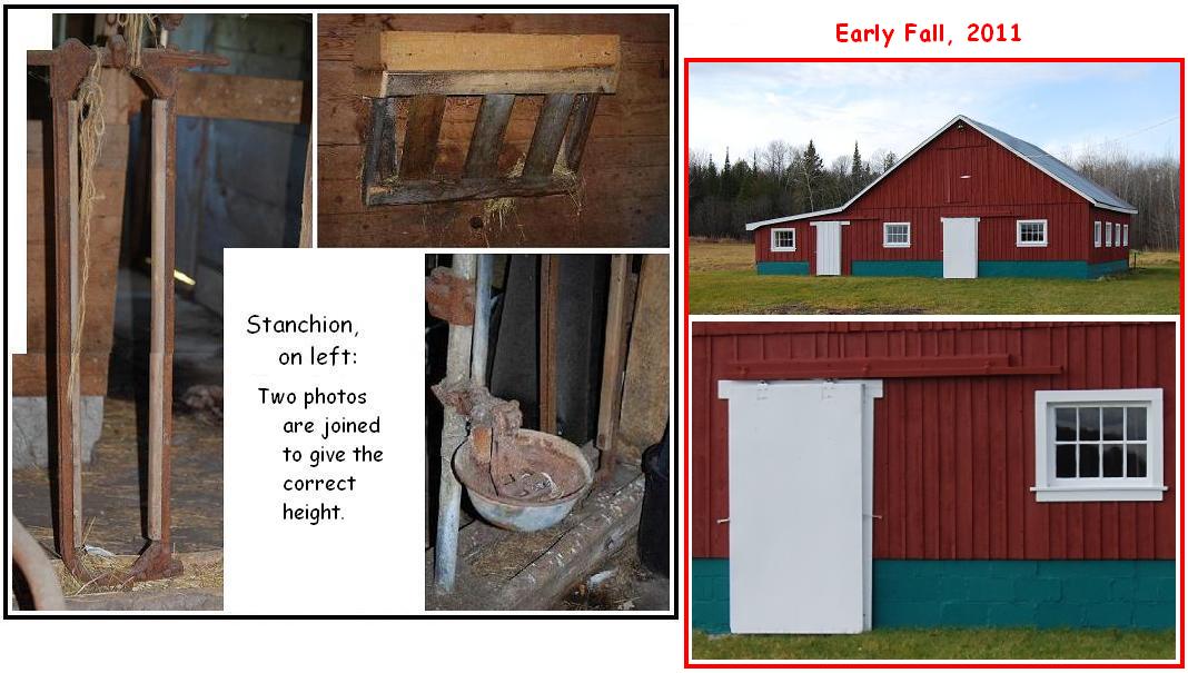
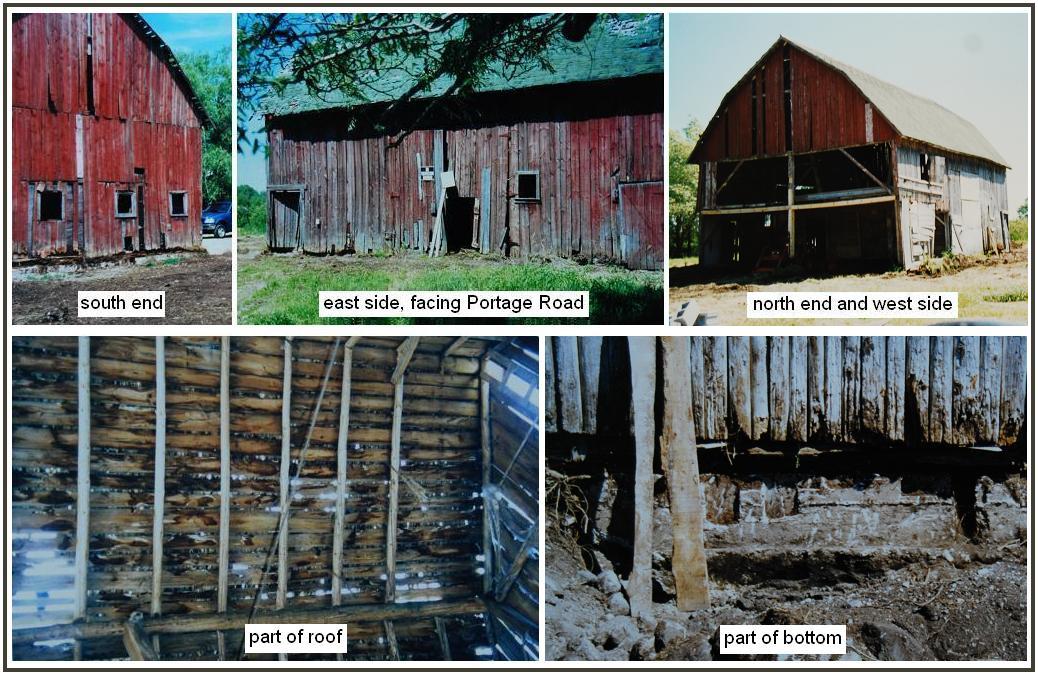
*Ne1. (west of Greenwald Rd.; NE¼ sec.25, T.43N.-R.11W.) (#2,
Greenwald Farm in Engadine Museum display)
Ne2. (south of Rte. 2; NE¼ sec.25, T.43N.-R.11W.
Ne4. (north of Clark Rd.; SE¼ sec.28, T.43N.-R.11W.)
Ne11. (north
of Clark Rd.; SE¼ sec.28, T.43N.-R.11W.)
.
Ne5. (east of Brawley Rd.; NW¼ sec.26, T.43N.-R.11W.)
Ne6. (west of S. Gould City Rd.; SW¼ sec.28, T.42N.-R.11W.)
Ne7. (east of S. Gould City Rd.; SW¼ sec.21, T.42N.-R.11W.)
Ne8. (south
of Main St., Gould City; SW¼ sec.28, T.43N.-R.11W.)
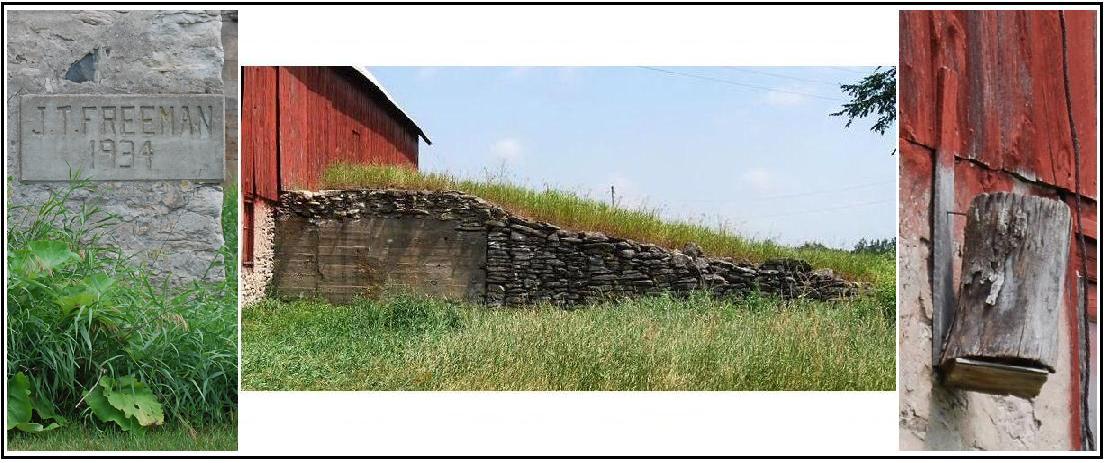
*Ne9. (north of Hiawatha Trl. [=H40]; NE¼ sec.23, T.43N.-R.11W.) (#13,
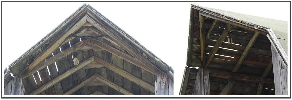
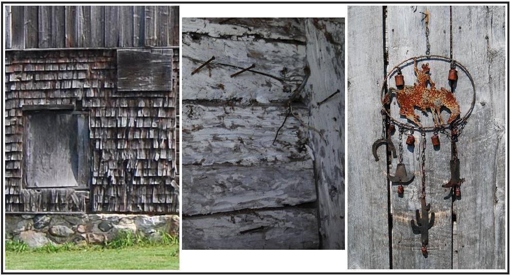
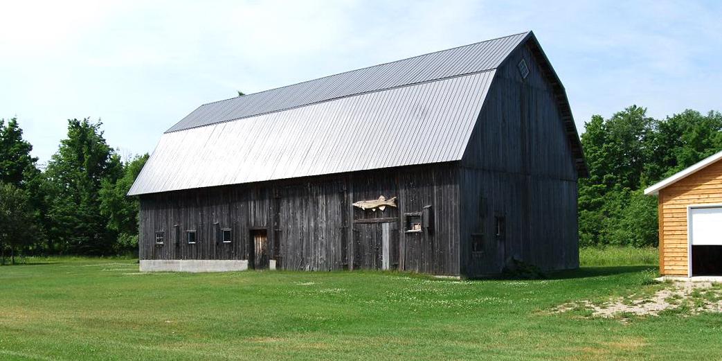
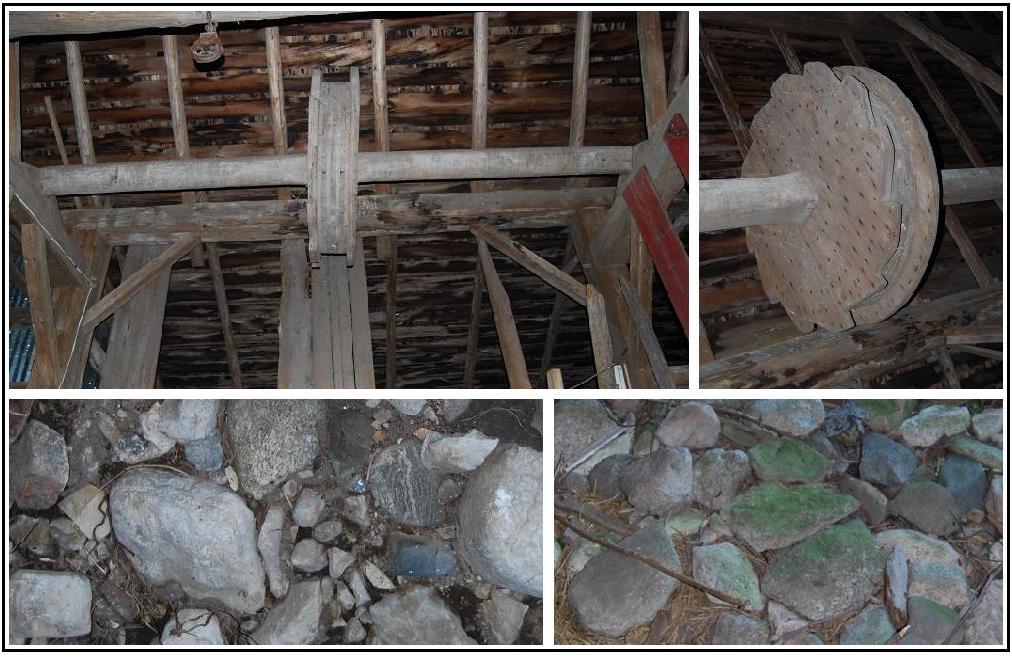
Freeman Farm, in Engadine Museum display)
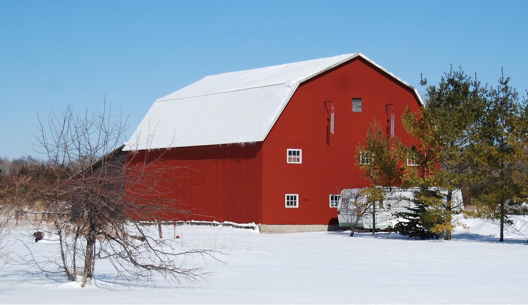
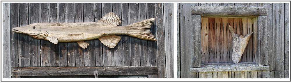
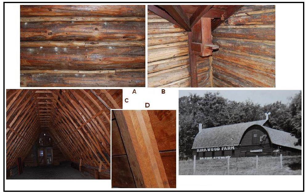
Right
(in composite, a short piece of log atop a "shelf" that is attached to
a board that, in turn, is attached to the a vertical wooden boards of
the barn for .
. .
- I
hesitate even to guess what its function may have been.
The feature shown on the right
side of the composite led me to see if a lady who was "brought up" on
the farm might
know what it had as a function. She indicated that she had no
recollection of the feature. Photographs of the barn that are
in the Engadine Historical Museum
substantiate her remarks -- i.e., the feature was not there when the
photographs were taken.
If the dates when the photographs
were taken and when the barn was last painted can be found, the
time period during which
this feature was added will be
known. But, will even that information give a clue to the
function of this feature?
For the record, the guesses as to
its function that were made by the readers include the following:
1) A perch of some kind, probably for a pet raven.
2) A
place -- i.e., beneath the log -- for a visitor who found noone
at home to leave a note. (Considering the shelf's
height this suggested use would indicate that visitors who knew of this
function were rather tall.)
3) A family joke of some sort whose meaning has been lost in time.
4) Before the barn had electricity a lamp (kerosene?) was put on that
little platform; later, when they got elec-
tricity, they no
longer needed the lamp; then, one day, just on a whim, somebody
put the stump up there.
5) For woodpeckers?
6) A conversation starter for visitors, or anyone else, who sees it.
And, one reader asked me:
"When you first looked at ... [it], were you 'stumped'?"
Perhaps
someone who knows will see this and tell us what it really was meant to
be. If so, I will add that to this caption.
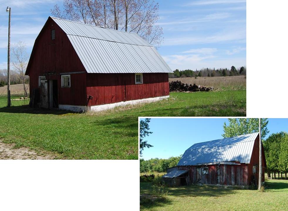
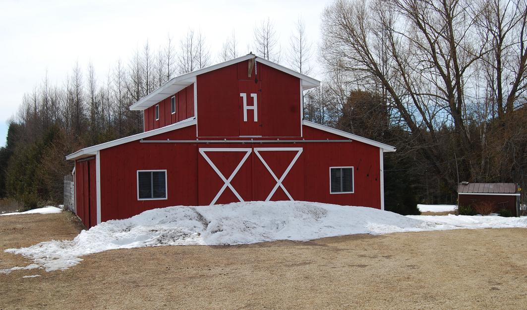
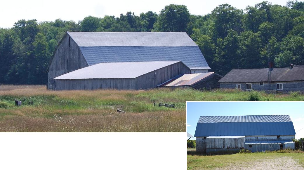
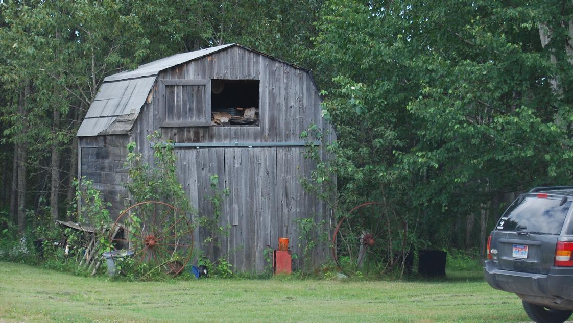
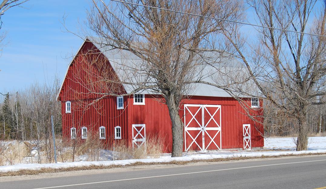
Ne12. (north of Rte. 2; SE¼ sec.24, T.43N.-R.11W.)
No photograph or information about this barn was included in the
original report that is available on the Michigan
Barns Preservation Network web site.
This barn
was overlooked
despite the fact that it can be seen from Rte. 2. A dairy and hay
barn, it was built in the late 1920s or early 1930s for Michael
Ozanich. Loose hay was stored from floor to roof in one part of
the barn and in a mow above the "dairy parlor." Stanchions
are still within that latter part of the barn.
[The
above information is from Brent Geske, the current owner.]
Ne13. (northwest of Long Lake north of
Rte. 2; SE¼ sec.16?, T.43N.-R.12W.)
No photograph or information about this barn was included in the
original report that is available on the Michigan
Barns Preservation Network web site.
This barn, which has a rather remote location,
was not seen during the original study. Relatively
small, it is said to have been built for Herb Burton in the
mid-1970s and to have been used as a cattle barn. It includes
what was a hay mow in its upper level and had stanchions for three to
five
milch cows.
[The
above information was given orally by Brian Burton.]
~~&extras&~~
Ne10. (north of Hiawatha Trl.[=H40]; NE¼ sec.23, T.43N.-R.11W.) Extra no. 15:
Ne3. (north of Brotherton Rd.; SW¼ sec.2, T.43N.-R.12W.) Extra no. 16:
PORTAGE
Township.
Po1. (east of Rte. H33; SW¼ sec.30, T.44N.-R.11W.)
.
Po2. (east of County Line Rd.; SW¼ sec.7, T.44N.-R.12W.)
Po3. (south of Ketola Rd.; NE¼ sec.7, T.44N.-R.12W.)
Po4. (east of County Line Rd.; NW¼ sec.7, T.44N.-R.12W.)
Po7. (north of Sandtown Rd.; SW¼ sec.17,
T.44N.-R.11W.)
~~&an extra&~~
Po5. (east of McGahn Rd.; SE¼ sec.17, T.44N.-R.12W.) Extra no. 17:
.
Si1. (north
of Charles Moran Rd.; SE¼ sec.30, T.41N.-R.3W.)
Si2. (west of
Pine River Rd.; NE¼ sec.10, T.42N.-R.3W.)
Si3. (south
of Rte. 123; NE¼ sec.11, T.41N.-R.3W.)
Si4. (north
of St. Ignace Rd.; SE¼ sec.1, T.42N.-R.3W.)
~~&+&~~
Mackinac
Island (City).
MIC8. (north
of Algonquin Rd.; SW¼ sec.10, T.40N.-R.3W.)
MIC7. (north
of Algonquin Rd.; SW¼ sec.10, T.40N.-R.3W.)
MIC6. (north
of Algonquin Rd.; SW¼ sec.10, T.40N.-R.3W.)
MIC1. (east of
Market St.;
SW¼ sec.14, T.40N.-R.3W.)
MIC2. (northeast
of Cadotte St.; NE¼ sec.15, T.40N.-R.3W.)
MIC12. (north
of Park Rd.; SW¼ sec.3, T.40N.-R.3W.)
MIC13. (east of
Carriage Rd.; SE¼ sec.10, T.40N.-R.3W.)
~~&+&~~
St. Ignace, City.
SIC1. (north
of Ferry Ln.; SW¼ sec.17, T.40N.-R.3W.)
SIC2. (south
of Burdette St.; SW¼ sec.17, T.40N.-R.3W.)
SIC3. (north
of Portage St.; SW¼ sec.7, T.40N.-R.3W.)
~~&an extra&~~
SIC4. (south
of Prospect St.; NW¼ sec.18, T.40N.-R.3W.) Extra no. 18:
| Home
|
Appendix. Locations: State outline map, County map with township
borders, and List, by township,
of the barns and "extras" of which photographs are included in this album.
Sketch map.
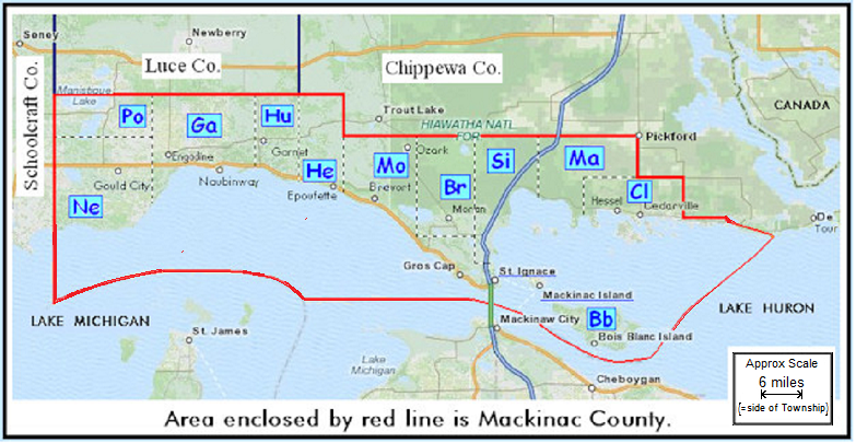
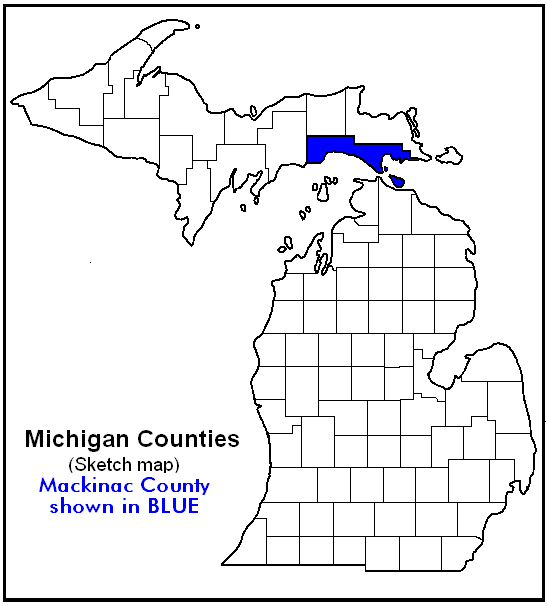
Location of Mackinac County within State of Michigan.
Sketch map.
Locations of townships within Mackinac County. The
black and white dashed lines indicate the approximate
boundaries between adjacent townships.
The two-letter indicators on this map are used to designate the
townships where the barns are located in both the captions of the photographs and on the following
list. West to east the correlations of the two-letter indicators
and full names are: Ne-Newton, Po-Portage,
Ga-Garfield, Hu-Hudson, He-Hendricks, Mo-Moran,
Br-Brevort, Si-St. Ignace, Ma-Marquette, Cl-Clark
and Bb-Bois Blanc.
Two additional indicators, MIC and SIC, are similarly utilized for the
included barns that are on Mackinac Island and in St. Ignace, respectively.
~~&&~~
List
of photographed barns
and"extras" by Townships. These
locations are plotted by number on the latest Plat Book ... (Mackinac
County ..., 2009). The page number in that book is given directly after
the number given each structure on this list. That book and
additional photos on CD are on file in the XXnameXX Library, XXplaceXX, Michigan.
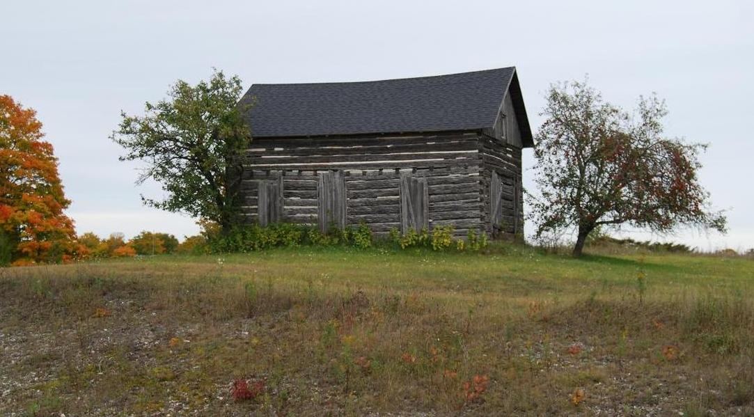
Bois Blanc Township
Bb1. (p. 44=extra #1) north of Lime
Kiln Point Rd.; SE¼ sec.17* T.39N.-R. 2W.
*see text re section
designation.
Brevort Township
[[7 + 4 extras]]
Br1. (p. 36=extra #2) east of
H57; SW¼
sec.2,
T.41N.-R.5W.
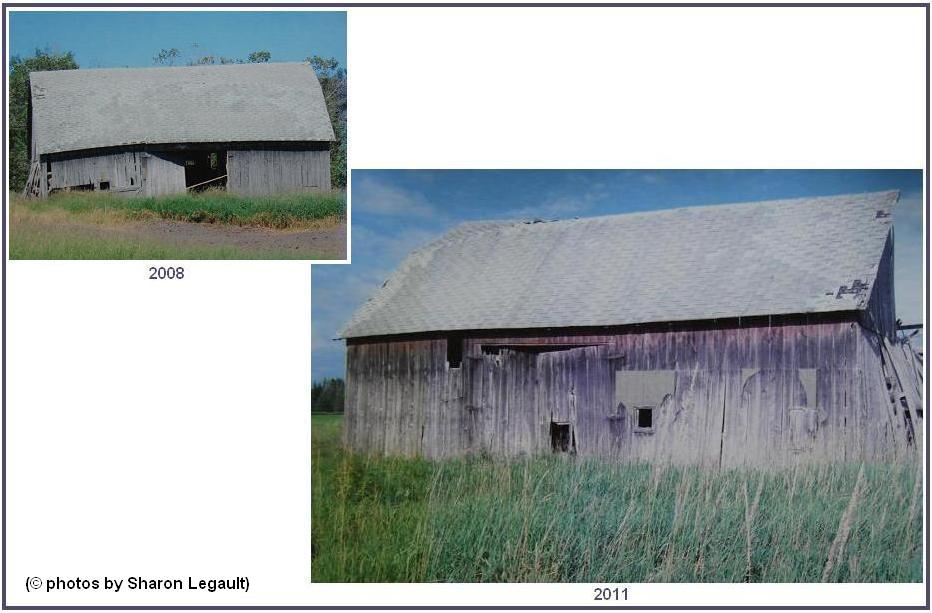
Br2.
(p. 36)
west
of H57; NW¼ sec.2,
T.41N.-R.5W.
Br3.
(p. 37) south of H57; NW¼ sec.5,
T.41N.-R.4W.
Br4.
(p. 31=extra #3))
north
of H57; NW¼ sec.32,
T.42N.-R.4W.
Br5.
(p. 31)
north
of Dukes Rd.; NE¼ sec.31,
T.42N.-R.4W.
Br6.
(p. 31)
south
of Dukes Rd.; SE¼ sec.31,
T.42N.-R.4W.
Br7. (p. 37=extra #4)
north
of Rte. 129; SE¼ sec.4,
T.41N.-R.4W.
Br9.
(p. 30) west of Black
Point Rd.; SE¼ sec.25,
T.42N.-R.5W.
Br10.
(p. 37)
east of Langdon Rd.; NE¼ sec.5,
T.41N.-R.4W.
Br11.
(p. 31)
east of Martin Rd.; NW¼ sec.33,
T.42N.-R.4W.
Br12.
(p. 30=extra #5) west
of Black Point Rd.; SW¼ sec.36,
T.42N.-R.5W.
Br13.
(p. 32=extra #5a) west
of Rte. 123.; SW¼ sec.4,
T.41N.-R.4W.
Clark Township [[9 + 1 extra]]
Cl1.
(p. 34) north of Nye Rd.; SW¼ sec.21,
T.42N.-R.1W.
Cl2. (p. 34=extra #6) south of State
St.; SW¼ sec.25,
T.42N.-R.1W.
Cl3. (p. 35) east of Meridian
St.; NW¼ sec.31,
T.42N.-R.1E.
Cl4. (p. 35) north of Norquist Rd.; SE¼
sec.18,
T.42N.-R.1E.
Cl5. (p. 35) north of Swede Rd.; SE¼
sec.7,
T.42N.-R.1E.
Cl6. (p. 35) west of Winberg
Rd.; SW¼
sec.9,
T.42N.-R.1E.
Cl7. (p. 35) north of Swede Rd.; SW¼
sec.9,
T.42N.-R.1E.
Cl8. (p. 35) south of Swede Rd.; NE¼
sec.15,
T.42N.-R.1E.
Cl9. (p. 35) east of Rte. 129; SW¼
sec.18,
T.42N.-R.1E.
Cl11. (p. 35)
south
of 30 Mile Rd.; NE¼ sec.1,
T.42N.-R.1E.
(= #105, p.45 in
Pickford..., 2004)
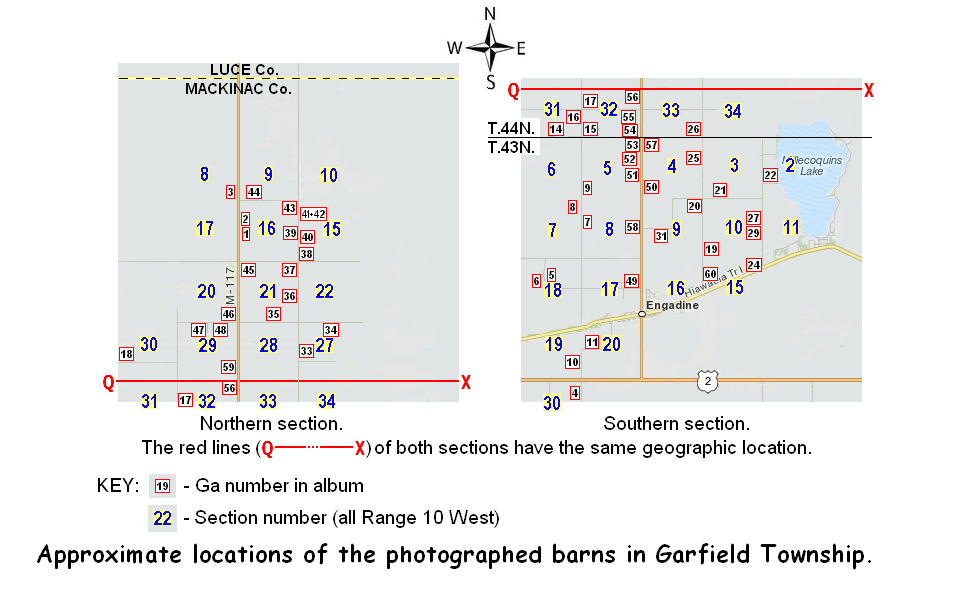
Garfield Township [[50(+3) + 4 extras]]
The
following sketch map shows the locations of the
barns shown by photographs in this album. It is given, along with
the list of locations, because the numbers of the photographs, and thus
of the locations, do not have any logical relationship to the roads and
geography. They are, instead, in the order in which the
photographs were taken, and that depended upon such things such as
light conditions and traffic. It is hoped that the map will aid
anyone going through the area who might want to correlate their travel
plans and routes they take to see the photographed
barns.
Ga1. (p. 11) east of Rte. 117; SW¼ sec.16,
T.44N.-R.10W.
Ga2. (p. 11) east of Rte. 117; NW¼ sec.16,
T.44N.-R.10W.
Ga3. (p. 11) west of Rte. 117; SE¼ sec.8,
T.44N.-R.10W.
Ga4. (p. 17)west of Price Rd.; NE¼ sec.30,
T.43N.-R.10W.
Ga5. (p. 17)south of Linck Rd.; NW¼ sec.18,
T.43N.-R.10W.
Ga6. (p. 17)south of Linck Rd.; NE¼ sec.18,
T.43N.-R.10W.
Ga7. (p. 17)east of Pleasant Ave.; NW¼ sec.8,
T.43N.-R.10W.
Ga8. (p. 17)west of Pleasant Ave.; NE¼ sec.7,
T.43N.-R.10W.
Ga9. (p. 17)east of Pleasant Ave.; SW¼ sec.5,
T.43N.-R.10W.
Ga10. (p. 17)west of Price Rd.; SE¼ sec.19,
T.43N.-R.10W.
Ga11. (p. 17)north of Price Rd.; NW¼ sec.20,
T.43N.-R.10W.
Ga12. (p. 17=extra #7)north of Linck Rd.; SE¼ sec.8,
T.43N.-R.10W.
Ga13. (p. 17=extra #8)west of Pleasant
Ave.; SE¼ sec.6,
T.43N.-R.10W.
Ga14. (p. 11)north of Patzen Rd.; SW¼ sec.31,
T.44N.-R.10W.
Ga15. (p. 11)east of Pleasant Ave.; SW¼ sec.32,
T.44N.-R.10W.
Ga16. (p. 11=extra #9)west of Pleasant
Ave.; NE¼ sec.31,
T.44N.-R.10W.
Ga17. (p. 11)east of Pleasant Ave.; NW¼ sec.32,
T.44N.-R.10W.
Ga18. (p. 11)north of Kovar Rd.; NW¼ sec.30,
T.44N.-R.10W.
Ga19. (p. 17)east of Krause Rd.; SW¼ sec.10,
T.43N.-R.10W.
Ga20. (p. 17)south of Raski Rd.; NE¼ sec.9,
T.43N.-R.10W.
Ga21. (p. 17)north of Raski Rd.; SW¼ sec.3,
T.43N.-R.10W.
Ga22. (p. 17)east of Indian Trl.; SW¼ sec.2,
T.43N.-R.10W.
Ga24. (p. 17)north of Hiawatha Trl. [Rte. H40]; NE¼ sec.15,
T.43N.-R.10W.
Ga25. (p. 17)west of Krause Rd.; NE¼ sec.4,
T.43N.-R.10W.
Ga26. (p. 11) west of Krause Rd.; SE¼ sec.33,
T.44N.-R.10W.
Ga27. (p. 17) west of Indian
Trl.; NE¼ sec.10,
T.43N.-R.10W.
Ga29.
(p. 17) west of Indian
Trl.; SE¼ sec.10,
T.43N.-R.10W.
Ga30. (p. 17) southeast of
Raski Rd.; SE¼ sec.9,
T.43N.-R.10W.
Ga31. (p. 17) south of Raski Rd.;
SW¼ sec.9,
T.43N.-R.10W.
Ga32. (p. 11=extra #10) west of Krause Rd.;
NE¼ sec.33,
T.44N.-R.10W.
Ga33. (p. 11)
east of Krause Rd.;
NW¼ sec.27,
T.44N.-R.10W.
Ga34. (p. 11) south of McKelvey Rd.;
NW¼ sec.27,
T.44N.-R.10W.
Ga35. (p. 11) north
of McKelvey Rd.;
SW¼ sec.21,
T.44N.-R.10W.
Ga36. (p. 11) west
of Krause Rd.;
SW¼ sec.21,
T.44N.-R.10W.
Ga37. (p. 11)
west of Krause Rd.;
NW¼ sec.21,
T.44N.-R.10W.
Ga38. (p. 11) north
of Sandtown Rd.;
SW¼ sec.15,
T.44N.-R.10W.
Ga39. (p. 11) west
of Krause Rd.;
SE¼
sec.16,
T.44N.-R.10W.
Ga40. (p. 11)
east of Krause Rd.;
SW¼ sec.15,
T.44N.-R.10W.
Ga41. (p. 11)
east of Krause Rd.;
NW¼ sec.15,
T.44N.-R.10W.
Ga42. (p. 11)
east of Krause Rd.;
NW¼ sec.15,
T.44N.-R.10W.
Ga43. (p. 11)
west of Krause Rd.;
NW¼ sec.16,
T.44N.-R.10W.
Ga44.
(p. 11)
north
of Brown Rd.;
SE¼
sec.9,
T.44N.-R.10W.
Ga45.
(p. 11)
east
of Rte. 117;
NW¼ sec.21,
T.44N.-R.10W.
Ga46.
(p. 11)
west
of Rte 117; SE¼ sec.20,
T.44N.-R.10W.
Ga47.
(p. 11)
south
of McKelvey Rd.;
NW¼
sec.29,
T.44N.-R.10W.
Ga48.
(p. 11) south
of McKelvey Rd.;
NE¼
sec.29,
T.44N.-R.10W.
Ga49. (p. 17)
west of Rte.117;
NE¼
sec.17,
T.43N.-R.10W.
Ga50. (p. 17)
east of Rte.117;
SW¼ sec.4,
T.43N.-R.10W.
Ga51. (p. 17)
west of Rte.117;
SE¼
sec.5,
T.43N.-R.10W.
Ga52. (p. 17)
west of Rte.117;
NE¼
sec.5,
T.43N.-R.10W.
Ga53. (p. 17)
west of Rte.117;
NE¼ sec.5,
T.43N.-R.10W.
Ga54. (p. 11)
west of Rte.117;
SE¼
sec.32,
T.44N.-R.10W.
Ga55. (p. 11)
west of Rte.117;
SE¼ sec.32,
T.44N.-R.10W.
Ga56. (p. 11)
west
of Rte. 117; NE¼ sec.32,
T.44N.-R.10W.
Ga57. (p. 17) east of Rte. 117; NW¼ sec.4,
T.43N.-R.10W.
Ga58. (p. 17) west of Rte. 117; NE¼ sec.8,
T.43N.-R.10W
Ga59. (p. 11) west of Rte. 117; SW¼ sec.29,
T.44N.-R.10W.
Ga60. (p. 17) north of Hiawatha Trl.; NW¼ sec.15,
T.43N.-R.10W.
Ga61. (p. 11) northeast of Warner Rd.; NE¼ sec.27,
T.44N.-R.10W.
Ga63. (p. 11) north
of McKelvy Rd.; SE¼ sec.20,
T.44N.-R.10W.
Ga64. (p. 11) north
of McKelvy Rd.; SE¼ sec.20,
T.44N.-R.10W.
(The last two are additions
to the first 135; they are NOT plotted on the preceding map.)
Hendricks Township [[1 + 1 extra]]
He1. (p. 20=extra #11) north of Epoufette
Bay Rd.; SW¼ sec.3,
T.42N.-R.7W.
He3. (p. 20) south end of
Kenyon Rd.; NE¼ sec.8,
T.42N.-R.7W.
Hudson Township [[0 + 1 extra]]
Hu1.
(p. 19=extra #12) west of Black
River Rd.; SE¼ sec.19,
T.43N.-R.8W.
Marquette Township [[24 + 2 extras]]
Ma1.
(p. 25=extra #13)
east
of Simmons Rd.; SW¼ sec.30,
T.43N.-R.2W.
Ma2.
(p. 33) south of St.
Ignace Rd.; NE¼ sec.9,
T.42N.-R.2W.
Ma3. (p.
33=extra #14) north of St.
Ignace Rd.; SE¼ sec.9,
T.42N.-R.2W.
Ma4.
(p.
26) north of Taylor
Rd.; SE¼ sec.9,
T.43N.-R.1W
Ma5. (p.
26) south of Taylor
Rd.; NW¼ sec.14,
T.43N.-R.1W
Ma6.
(p.
26) west of Rte.
48/129; NE¼ sec.24,
T.43N.-R.1W
Ma7.
(p.
26) west of Rte.
48/129; NE¼ sec.25,
T.43N.-R.1W
Ma8.
(p.
26) south
of Rockview Rd.; NW¼ sec.36,
T.43N.-R.1W.
NOTE: A black and white
photograph and information about each of the following barns is in
Pickford..., 2004. The photos shown in this album provide a
different view, taken in 2011, of each of these barns. The
numbers following the MaP- prefix indicate the order in which these
photographs were taken, which also provides a good order to view the
barns. The information in parentheses at the end of each barn
location corresponds to the number and page where information about the
barn is in the Pickford ... (2004) publication. It seems
noteworthy that five additional barns, no longer present, are also
shown in the Mackinac County section recorded in Pickford ...
(ibid.)
MaP-1. (p.
26) south
of Townline Rd.; NW¼ sec.1,
T.43N.-R.1W. (= #56, p.28)
MaP-2. (p. 26)
south of Townline Rd.; NE¼ sec.6,
T.43N.-R.2W.
(= #24, p.16)
MaP-3. (p. 26)
east
of 5 Mile Rd.; NE¼ sec.6,
T.43N.-R.2W.
(= #26, p.16)
MaP-4. (p.
26)
south of Townline Rd.; NW¼ sec.5,
T.43N.-R.2W.
(= #32, p.19)
MaP-5. (p.
26) south of
Townline Rd.; NW¼ sec.5,
T.43N.-R.1W.
(= #34, p.20)
MaP-6.
(p. 26)
south of Townline Rd.; NW¼ sec.2,
T.43N.-R.1W. (= #54, p.27)
MaP-7.
(p.
26) north
of Blair Rd.; SE¼ sec.1,
T.43N.-R.1W.
(= #58, p.28)
MaP-8.
(p.
26) south
of Blair Rd.; NE¼ sec.12,
T.43N.-R.1W.
(= #59, p.29)
MaP-9.
(p. 26) south of Blair Rd.; NE¼ sec.12,
T.43N.-R.1W. (= #61, p.29)
MaP-10.
(p. 26) west of 1 Mile
Rd.; SW¼ sec.2,
T.43N.-R.1W. (= #62, p.30)
MaP-11.
(p.
26) north of Blair
Rd.; SW¼ sec.2,
T.43N.-R.1W.
(= #64, p.31)
MaP-12.
(p.
26) north of Blair
Rd.; SW¼ sec.2,
T.43N.-R.1W.
(= #65, p.31)
MaP-13.
(p.
26)
north
of Bla;ir Rd.; SE¼ sec.3,
T.43N.-R.1W.
(= #67, p.32)
MaP-14.
(p.
26)
north
of Blair Rd.; SE¼ sec.4,
T.43N.-R.1W.(= #68, p.32)
MaP-15.
(p.
26) south Taylor
Rd.; NE¼ sec.14,
T.43N.-R.1W.
(= #69, p.33)
MaP-16.
(p.
26) south Taylor
Rd.; NE¼ sec.13,
T.43N.-R.1W.
(= #71, p.34)
MaP-17.
(p.
26) west of Rte.
129/48; SE¼ sec.12,
T.43N.-R.1W.
(= #72, p.34)
MaP-18.
(p.
26) west of Rte.
129/48; NE¼ sec.12,
T.43N.-R.1W.
(= #73, p.35)
MaP-19.
(p.
26) south
of Blair Rd.; NE¼ sec.12,
T.43N.-R.1W. (= #57, p.29
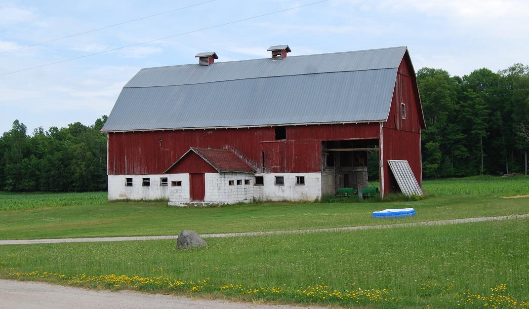
Moran Township [[5 + 0 extras]]
Mo1.
(p. 41)
northwest of New Portage Rd.; NW¼ sec.14,
T.40N.-R.4W.
Mo2. (p. 41)
south of Old
Portage Rd.; NW¼ sec.1,
T.40N.-R.4W.
Mo3. (p.
41)
northwest of
Martin Lake Rd.; NW¼
sec.9,
T.40N.-R.4W.
Mo4. (p.
22) north of
Lovegrove Rd.; SE¼ sec.4,
T.43N.-R.5W.
Mo6. (p.
41)
east of Gros
Cap Rd.; NW¼
sec.8,
T.40N.-R.4W.
Mo7. (p. 41) east of East Martin Lake Rd;
NE¼ sec.9,
T.40N.-R.4W.
(This last one
is an addition to the first 135.)
Newton Township [[9 + 2 extras]]
Ne1. (p. 16) west of Greenwald
Rd.; NE¼ sec.25,
T.43N.-R.11W.
Ne2. (p. 16) south of Rte. 2; NE¼ sec.25,
T.43N.-R.11W.
Ne3. (p. 15=extra #16) north of
Brotherton Rd.; SW¼
sec.2,
T.43N.-R.12W.
Ne4. (p. 16) north of Clark Rd.; SE¼ sec.28,
T.43N.-R.11W.
Ne5. (p. 16) east of Brawley
Rd.; NW¼ sec.26,
T.43N.-R.11W.
Ne6. (p. 28) west of S. Gould City Rd.; SW¼ sec.28,
T.42N.-R.11W.
Ne7. (p. 28) west of S. Gould City Rd.; SW¼
sec.28,
T.42N.-R.11W.
Ne8. (p. 16) south of Main St., Gould City; SW¼ sec.28,
T.43N.-R.11W.
Ne9. (p. 16) north of Hiawatha
Trl.[=H40]; NE¼ sec.23,
T.43N.-R.11W.
Ne10. (p. 16=extra #15) north of
Hiawatha Trl.=H40]; NE¼ sec.23
T.43N.-R.11W.
Ne11. (p. 16) north of Clark
Rd.; SE¼ sec.28,
T.43N.-R.11W.
Ne12. (p. 16) north of Rte. 2; SE¼ sec.24,
T.43N.-R.11W.
Ne13. (p. 15) northwest of Long Lake
north of
Rte. 2; SE¼ sec.16?, T.43N.-R.12W.
(This last two -- i.e., Ne12
& Ne13
-- are additions to the first 135.)
Portage Township [[5 + 1 extra]]
Po1. (p. 10)
east
of Rte. H-33, SW¼ sec 30,
T.43N.-R.11W.
Po2. (p. 9)
east
of County Line Rd., SW¼ sec.7,
T.44N.-R.12W.
Po3. (p. 9)
south
of Ketola Rd., NE¼ sec.7,
T.44N.-R.12W.
Po4. (p. 9)
east
of County Line Rd., NW¼ sec 7,
T.44N.-R.12W.
Po5. (p. 9=extra #17)
east
of McGahn Rd., SE¼ sec 17,
T.44N.-R.12W.
Po7. (p. 10)
north
of Sandtown Rd., SW¼ sec.17,
T.44N.-R.11W.
St. Ignace Township [[4 + 0 extras]
Si1.
(p. 32) north of Charles
Moran Rd.; SE¼
sec.30,
T.41N.-R.3W.
Si2.
(p. 32)
west
of Pine River Rd.(south of Rte. 134); NE¼ sec.10,
T.42N.-R.3W.
Si3.
(p. 37) south of Rte. 129;
NE¼
sec.11,
T.41N.-R.3W.
Si4. (p. 32) north of St.
Ignace Rd.; SE¼
sec.1,
T.42N.-R.3W.
Mackinac Island, City [[7 (+2) + 0 extras]]
MIC1. (p. 42)East of Market St.; SW¼
sec.14,
T.40N. R.3W.
MIC3. (p. 42)Southwest of Cadotte St.; NE¼
sec.15,
T.40N. R.3W.
MIC6. (p. 42)North of Algonquin Rd.; SW¼
sec.10,
T.40N. R.3W.
MIC7. (p. 42)North of Algonquin Rd.; SW¼ sec.10,
T.40N. R.3W.
MIC8. (p. 42)North of Algonquin Rd.; SW¼
sec.10,
T.40N. R.3W.
MIC12. (p. 42)North of Park Rd.; SW¼ sec.3
,
T.40N. R.3W.
MIC13. (p. 42)East of Carriage Rd.; SE¼
sec.10,
T.40N. R.3W.
St. Ignace, City [[3 + 0 extras]]
SIC1.
(p. 41&
49) north of Ferry Lane; SW¼ sec.17,
T.40N.-R.3W.
SIC2. (p.
41& 49) south of
Burdette St.; SW¼ sec.17,
T.40N.-R.3W.
SIC3. (p.
41& 48) north of Portage
St.; SW¼ sec.7,
T.40N.-R.3W.
SIC4. (p.
41& 48=extra #18)) south of
Prospect St.; NW¼ sec.18,
T.40N.-R.3W.
Last update: 9 August 2018
© R.V. Dietrich 2018
| Home
|


 .
.